The Ems estuary is located along the border between Germany and the Netherlands. Ongoing human activities (e.g. deepening the channel) over the past decades has increased tidal amplification and asymmetry and led to a strong flood-dominant transport of sediments.
The present lower Ems has transformed into a hyper-turbid state and is characterized by thick and mobile fluid mud layers with thicknesses of 2m and more and suspended solid sediment concentrations of up to some hundred kg/m3. This situation is critical from the point of economy as well as from the point of ecology. To study the exchange mechanisms between the outer Ems and the lower Ems an ambitious survey programme with participation of 15 mainly Dutch or German authorities, institutes and universities, like Dutch Rijkswaterstaat, research institute Deltares or the Federal German Waterways Engineering and Research Institute BAW.
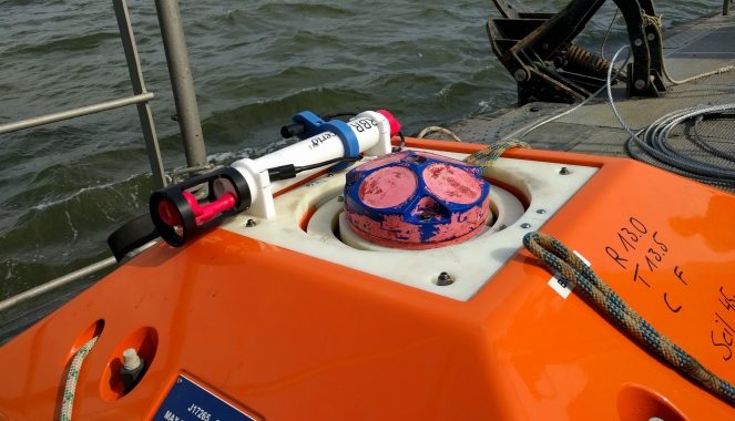
One part of the programme was a monitoring network to measure hydrodynamics and salinity intrusion into the estuary. For this purpose BAW has used combined mooring frames comprising ADCP and RBR concerto instruments. RBR has been chosen due to their small construction and the possibility to add additional sensors – like in this case Seapoint STM turbidity meter.
During two 4-week deployments RBRconcerto3s collected near bottom data of salinity and turbidity. Turbidity data have been calibrated in the lab against suspended solids concentration.